

FoCo - Coyote Ridge - Loveland - Devils Backbone - Blue Sky - Lory - Maxwell
This is a very technical route. Don’t be deceived by the first half. Hidden Springs road is heat mapped but looks like they close the gates sometimes, you could do a quick turn around and ride down Fossil Creek Trail to Taft to skip that part. Coyote Ridge lower trails are nothing but fun on a gravel bike. The segment through Loveland to get to Devils Backbone the back way is public according to the Larimer County GIS maps. The sector up to the Loveland star may have a community sign but the land is owned by the city of Loveland. On a capable gravel bike you’ll be surprised at how fun the Devils Backbone to Bluesky section is. We only had to walk 2 sectors but be prepared for technical slow riding uphill and downhill. See the Youtube vide below for some of the more technical bits.
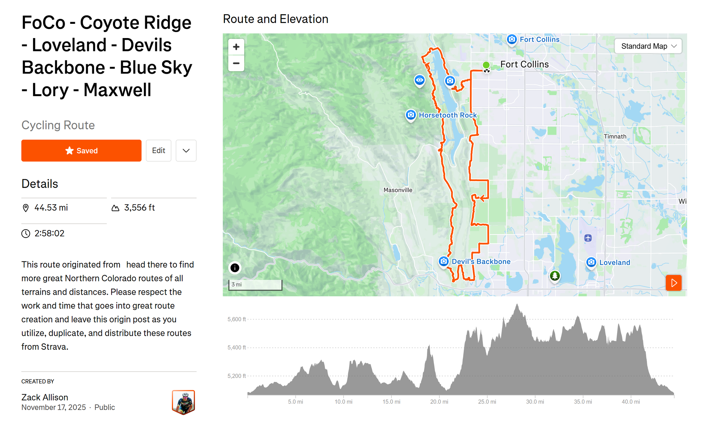
The Stats:
Distance: 45 miles
Paved: 20%
Climbing: 3600 feet
Notes: Some of the single track is quite technical.
Refills: Marina Store, Horsetooth and Lory State Park Trailheads
Tires: Zack was on a 2.25 wtb ranger front and a 2.0 Nano rear